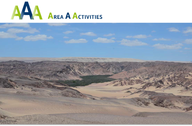
The One River Project (2012-2015) tracks the flux in rich cultural florescence and collapse through time along a single river – the Río Ica – from its headwaters in the southern Andes to its mouth on the desert past. Its Pacific coast is one of the world’s driest deserts, whose only reliable source of water are rivers arising in the rain-fed highland hinterlands. Second only to the Himalayas, the Andes encompass tremendous variations in human ecology, and, at these tropical latitudes, support cultivation even to extreme altitudes.
Our research studies the interdependency between the hydrology and economy of the coast and highlands taking a single watershed as our unit of analysis, modelling changes in settlement, land use, water management and culture. In particular we are interested in how human populations adapted the natural and physical landscape to their hydric needs.
Here we compare and contrast human management of land and water in the Ica Valley at two ends of extremes in time and space. At the river’s mouth on the Pacific shoreline we look to the first semi- sedentary fisher-hunter-gathers in the Middle Preceramic (c. 5,000 BC). Millennia later, then, in the river’s headwaters, between 2,800 and 4,400 m higher, we investigate those complex agro-pastoralist strategies for the exploitation of pasturage and construction of extensive agricultural terrace systems which became part of the Inca Empire (to AD 1532).
The contrasts between these case studies help draw out the long human trajectory across the extraordinary Andean topography, and how people here constructed and deconstructed their environment based on the short- and long-term decisions taken these same groups. In essence, we aim to understand the political ecology of the Ica Drainage populations through time.
